The Phoenix Mine
(Lode and Placer )
(40 acres)
Broadwater County, Montana
$43,000
Under Contract
(Lode and Placer )
(40 acres)
Broadwater County, Montana
$43,000
Under Contract
•Commodities: Silver, Gold, Lead, Copper
• Claim designation: un-patented lode and placer
• Size: 40 acres
• Location: Broadwater County, Montana
The Phoenix Mine is a documented mineral property in the historic Hassle mining district of Broadwater County Montana.
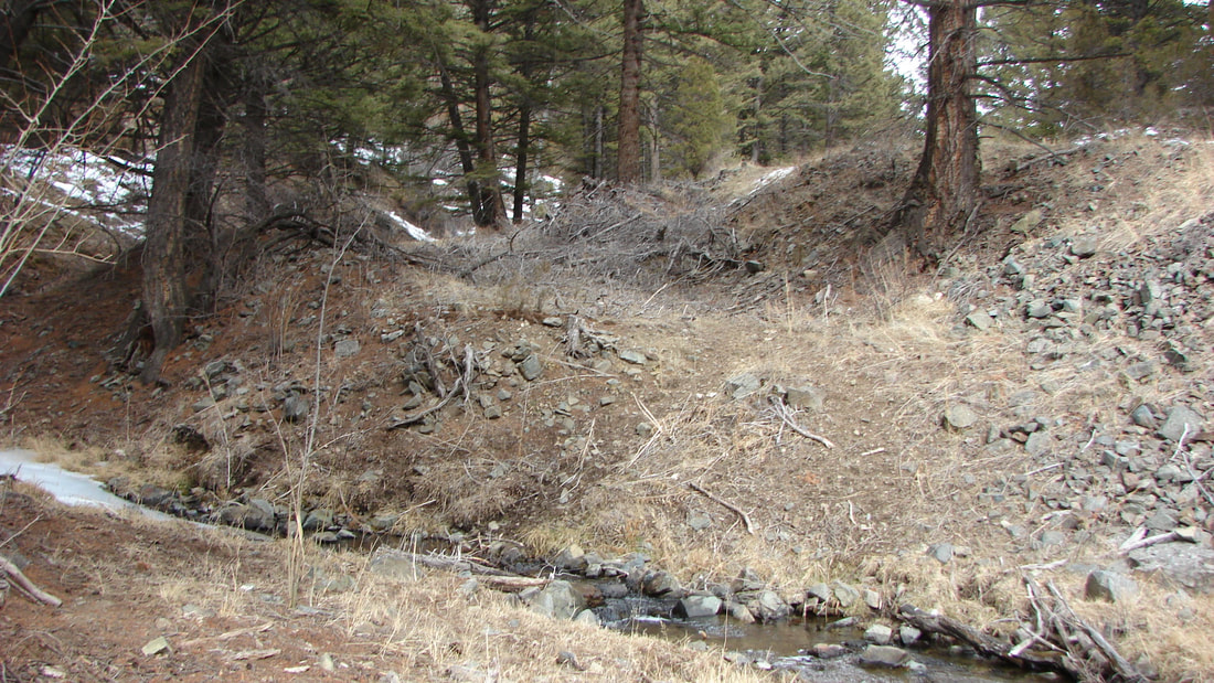
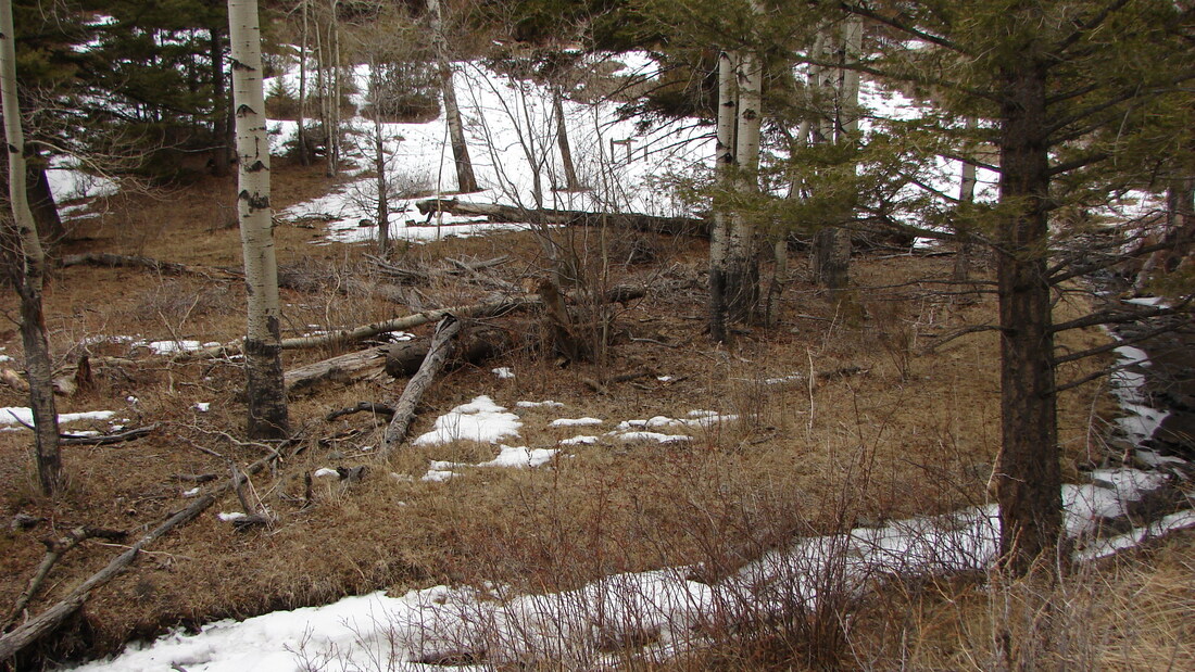
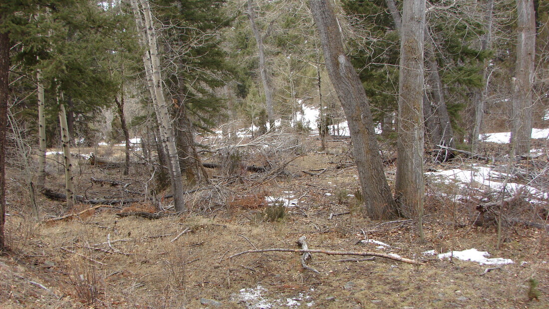
One of the last remaining underground mines available in the district; the Phoenix boasts an estimated 1500 feet in combined underground workings, heavily mineralized ore spill, over twelve hundred feet of annual flowing creek, placer Gold deposits in the bench gravels, and excellent access.
Renowned for high-quality Gold, and Silver in Montana, the Hassle district holds untapped potential for precious mineral recovery.
Underground workings will require a modern gate, with timbered bracing for continued exploration and development.
An estimated 5-10 yards of soil and overburden require removal for further exploration and development.
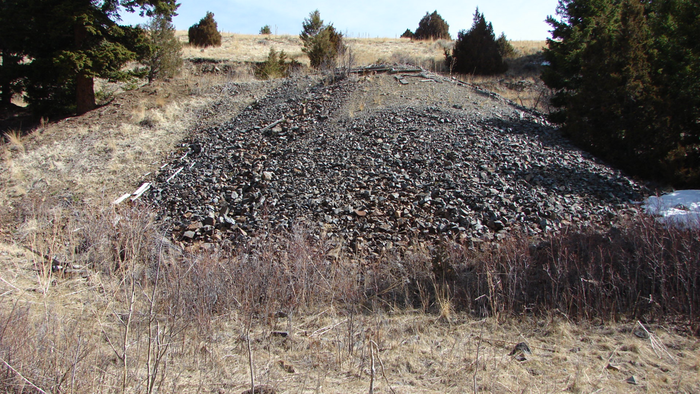
Mine spills consist of mid-grade ores from early production during the 1900s, as no mill is available onsite, only high-grade ore was shipped to a secondary processing location.
Mine spills on both adits are estimated at a combined 12,000-15,000 yards. Consisting of county host rock, argentiferous Galena, chalcopyrite, auriferous pyrites, and malachite intrusions.
At one time, both adits featured timbered shaft houses and snow tunnels to provide shelter and storage.
Remnants of the building materials and air vents are located near the upper spills.
Gold is of a course variety as most lode deposits are relatively near the placer base.
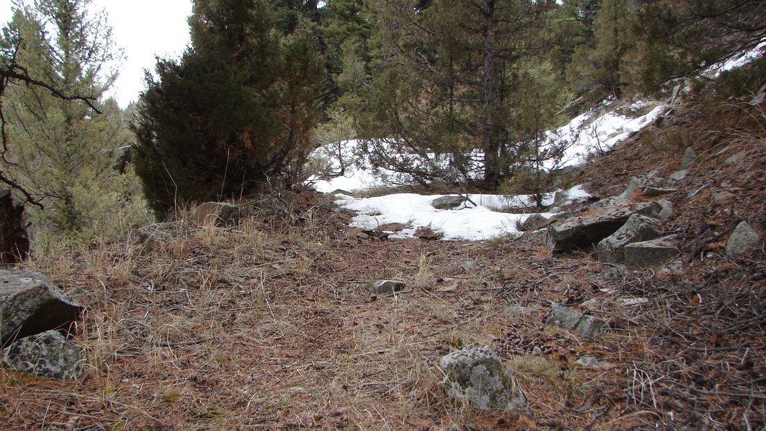
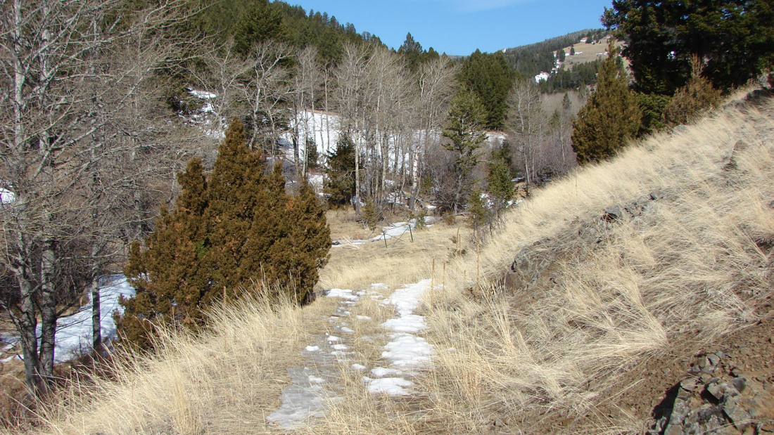
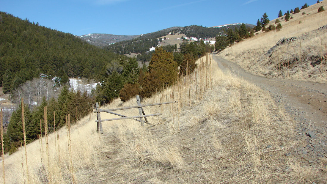
Accessible by a maintained dirt road, suitable for most vehicles and all 4x4s.
The older mine road runs south to the mines and creek-bed from Indian Creek Road.
A winter closure gate is in place about three hundred feet south of the old mine road and boundary, with parking available at the gate during the winter months.
The secluded location, along with the untapped potential of the aged workings is ready for the beginning enthusiast, up to an established mining company.
One of the last remaining underground mines available in the district; the Phoenix boasts an estimated 1500 feet in combined underground workings, heavily mineralized ore spill, over twelve hundred feet of annual flowing creek, placer Gold deposits in the bench gravels, and excellent access.
Renowned for high-quality Gold, and Silver in Montana, the Hassle district holds untapped potential for precious mineral recovery.
- Primary workings of two tunnel-style adits driven 85 degrees northwest into the heavily mineralized outcropping. An older caved inclined shaft was originally cut above the adit on the hillside to meet the NW trending vein structure.
Underground workings will require a modern gate, with timbered bracing for continued exploration and development.
An estimated 5-10 yards of soil and overburden require removal for further exploration and development.
- Estimated ore available ore grades are (0.89-to-2.1 OPT Au{Gold}), with )7-to-35.00 OPT Ag{Silver})
- Free milling Gold is available in the volcanically altered vein material.
- In addition to the established workings, multiple virgin outcroppings of the epithermal deposits are visible above and below the adit area, as exposed by older road cuts.
Mine spills consist of mid-grade ores from early production during the 1900s, as no mill is available onsite, only high-grade ore was shipped to a secondary processing location.
Mine spills on both adits are estimated at a combined 12,000-15,000 yards. Consisting of county host rock, argentiferous Galena, chalcopyrite, auriferous pyrites, and malachite intrusions.
At one time, both adits featured timbered shaft houses and snow tunnels to provide shelter and storage.
Remnants of the building materials and air vents are located near the upper spills.
- Placer Gold can be located in the upper bench deposits as well as the base creek gravels and bedrock deposits.
Gold is of a course variety as most lode deposits are relatively near the placer base.
- Estimated placer Gold Availability: 0.25-1.5 grams per yard.
Accessible by a maintained dirt road, suitable for most vehicles and all 4x4s.
The older mine road runs south to the mines and creek-bed from Indian Creek Road.
A winter closure gate is in place about three hundred feet south of the old mine road and boundary, with parking available at the gate during the winter months.
The secluded location, along with the untapped potential of the aged workings is ready for the beginning enthusiast, up to an established mining company.
Park/Hassle/Indian Creek district history
The Indian Creek mining district is located ten miles west of Townsend on the Northern Pacific Railway. The district first began to be worked in 1866 when good placer grounds were discovered in Indian Creek. By 1871 it is estimated that $50,000 had been taken from the gravels. Some bars yielded as much as $50 per man per day; the 100 men working the creek averaged $7 per man per day. The work was seasonal for as long as the water lasted. A dam was constructed in the 1870s to control the flow of water and to extend the placer season (Stone 1911; McCormick 1990).
The original placers were found in benches above Indian Creek. Materials ranged from small boulders to clay and sand, all of which were derived from andesite and sediments to the west. The lower Indian Creek placers worked in the 1940s were found in a false bedrock that was one to six feet in thickness and overlain by eight to ten feet of barren gravel (Lyden 1948).
By tracing the values upstream, veins were discovered in the immediate vicinity, and masses of mineralized porphyry in Diamond Hill. In the Park mines veins of andesite and diorite produced primarily pyrite, with some arsenopyrite and galena. In the area of Hassel, at least two intrusions of mineralized granite have been located in andesite porphyry. These ores yielded gold, silver, copper, and lead values.
Open pit mining and long tunnels in these large bodies and veins produced approximately $500,000 in gold. One tunnel, 2,800 ft. long is said to be all in ore assaying from 80 cents to $2.50 per ton. Three small stamp mills were built around Hassel and yielded $500 per day when water was available. At Park, a mill and cyanide plant were built, but the process was not suited to the ore.
In 1908 the combined Park and Hassel mines produced $5,313 in gold, 2,939 ounces of silver, 8,901 pounds of copper, and 27,374 pounds of lead. Estimates of total production for the district by 1911 were between $2 and 8 million, however, a more modest estimate made in 1933 of not less than $1 million is probably more likely (Stone 1911; Hill 1912; Pardee and Schrader 1933; Lyden 1948)